
Pelagonia (/ˌpɛləˈɡoʊniə/, pel-uh-GOH-nee-uh) is Avium's largest and second-most populated continent. In general terms, it is bounded on the north by the Sahara Sea and the portions of the Erythra River system south of Lake Charmuthas, separating it from Evria, and on the west by the Sea of Auritania and the Strait of Hollosend, separating it from Elysia. To the south and east, it is bounded by the Panthalassan Ocean. Pelagonia contains two sovereign states, with the remainder of the continent divided among ten colonial powers and their dependencies, the legacy of sustained Evrian imperial expansion during the late nineteenth century known as the Scramble for Pelagonia.
Etymology
The name ‘Pelagonia’ derives from the Rumaic pelagus, itself borrowed from the ancient Astriyan pélagos (πέλαγος), meaning "open sea" or "deep water." The suffix -onia, a common Rumaic geographic formant denoting lands or territories, was adopted as the continent entered formal cartographic usage. The compound thus carries the approximate sense of "the land beyond the open water.” The toponym likely originated as a navigational descriptor before it was adopted as a formal continental designation. Indigenous populations held their own names for the landmass and its regions, but Rumaic nomenclature became the internationally recognized standard following the late nineteenth-century colonial period.
Geography
Topography
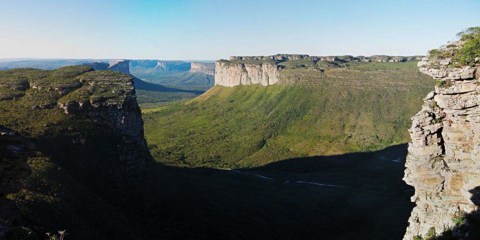
Pelagonia is divisible into four connected landmasses, separated from each other by active plate boundaries responsible for the continent's extensive rift lake systems. Its western face opens onto the Sea of Auritania, with the landmass tapering from the East Auritanian Plateau into a windswept, narrow strip of subtropical plains above the Argenteum river system, its southern coast dominated by the Riesengrat Cordillera. Aphirica, a predominantly low-lying tropical region, faces the Sahara Sea, rising inland onto a broad sedimentary plateau known as Central Pelagonia, extending southward through savanna into the Ocre and Brumes desert systems and terminating at the Strayan Sea. To the northeast, the densely populated Five Indies face eastward toward the Panthlassan Ocean, its interior dominated by the Daksina and Tobotean Plateaus, the latter of which is the highest and most extensive elevated terrain on Avium, bounded to the west by the Parvateshwaras and Mount Sagarmatha, Avium’s highest mountain above sea level. Further southward, the Strayan Peninsula is the oldest and most geologically stable body on the continent as well as the largest peninsula in Avium, with a largely arid flat interior ringed by a fertile coastal margin.
Climate
Pelagonia's distance from Hyperborea largely insulates it from the katabatic winds that define the climates of Evria, Valtheria, and Elysia. The result is the broadest climatic range of any continent on Avium, with no single dominant pattern.
Equatorial and tropical conditions prevail across Aphirica and the western lowlands, where mean temperatures remain between 25°C and 30°C year-round and annual rainfall exceeds 2,000 millimeters in the wettest zones. Central Pelagonia transitions progressively southward through savanna and semi-arid steppe into the hot desert climates of the Ocre and Brumes, where annual precipitation falls below 250 millimeters and summer temperatures regularly exceed 40°C, with winter lows of 10°C to 15°C. The southern cape of the continent experiences a Mediterranean-type climate of dry summers ranging from 20°C to 25°C and mild, wet winters of 8°C to 14°C, driven by seasonal pressure systems.
The Five Indies are dominated by monsoon circulation, with the Tobotean Plateau playing an outsized role in shaping regional weather patterns. Its mass drives the uplift that intensifies the seasonal monsoon across the subcontinent, delivering the majority of annual rainfall in a concentrated wet season, with coastal lowland temperatures ranging from 28°C to 35°C in the wet season and 15°C to 22°C in the dry, while casting a pronounced rain shadow across its northern and western interior. At altitude, the Parvateshwaras and other mountain ranges in the Tobotean Plateau maintain permanent glaciation, with plateau interior temperatures ranging from -20°C to -40°C in winter and 5°C to 15°C in summer.
The Strayan Peninsula's interior is largely arid, with summer highs of 35°C to 45°C and winter lows of 5°C to 12°C due to its distance from sources of moisture, while its coastal margins are considerably wetter, particularly in the north, where monsoonal influence extends from the Five Indies across the intervening seas.
Government
Pelagonia's political boundaries are largely a product of the Scramble for Pelagonia in the late nineteenth century, during which Evrian powers partitioned the continent's coastline and extended administration into portions of its interior. The Verdanie and Arunya are the continent's two sovereign states. In March 1931, Elvesterian colonial dependencies including the Golden Coast in Pelagonia and North Auritania in Elysia reverted to devolved local rule following the dissolution of the Mizuhara Pentapartite at the Fifth Pentapartite Conference. Elvester retains administrative control over Noradia. Ten powers hold colonial dependencies across the continent: Alemannia administers four, Arverne and Nichirin three each, with single dependencies under Turulia, Vicily, Ponurvia, Shivon, Skjarnland, and Karjania.